
The Master Map Series
Created by the National Land Agency
The National Land Agency (NLA), Jamaica’s official mapping Agency, offers a variety of customized and standardized mapping products ranging from: topographic, planimetric and cadastral maps, aerial photographs and digital parcel data.
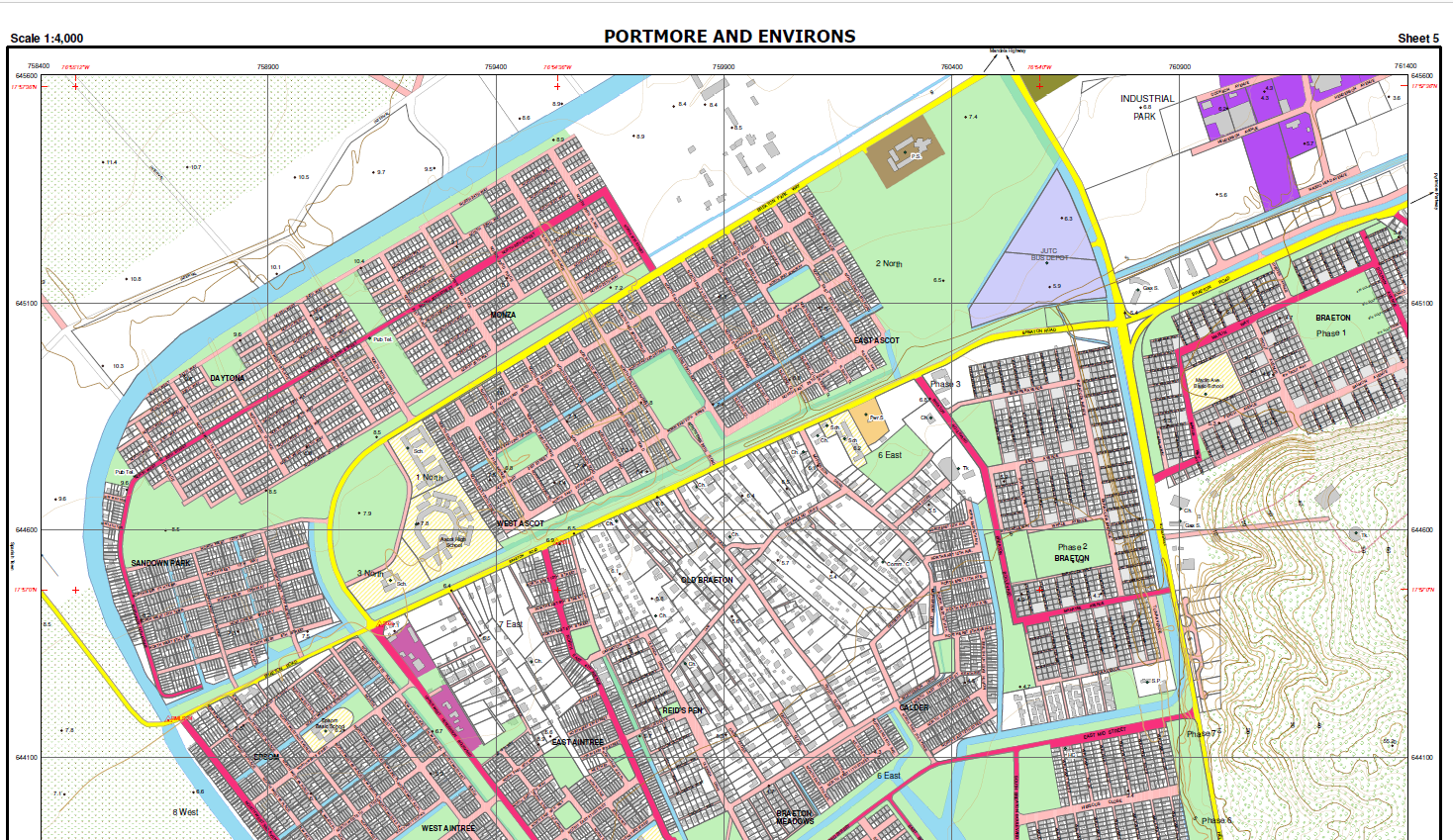
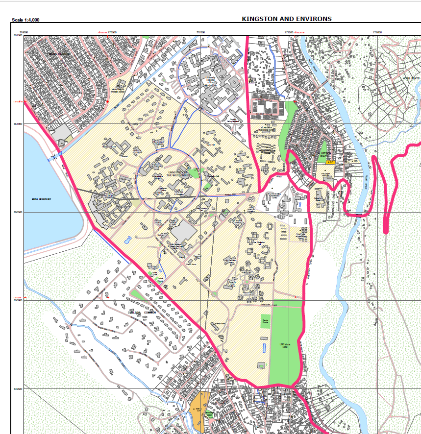
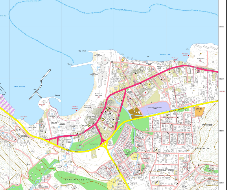
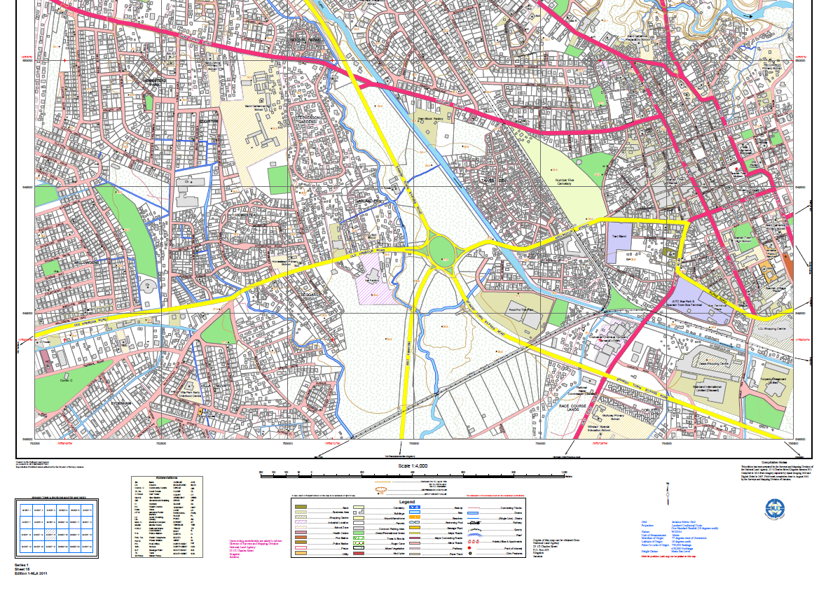
Since 2005, the NLA has produced twelve (12) Master Map Series, each at scale 1:4,000, depicting the natural and manmade features of the major towns across Jamaica. Available for purchase in hard and soft copy, the Master Maps can be used for development planning, modelling, navigation and visualization purposes.These maps are widely used by professionals within the Real Estate, Land Surveying, Architecture, Engineering, Construction, Education, Health, Fire, Criminology, Transportation, and Social Services sectors. The ease with which these maps may be used, makes them very suitable for use by general members of the public.
The following are the Master Maps completed as at March 31, 2023:
|
Town |
Year |
No. of Sheets |
|
2005 |
7 |
|
|
2010 |
26 |
|
|
2011 |
8 |
|
|
2012 |
24 |
|
|
2013 |
23 |
|
|
2014 |
15 |
|
|
2017 |
8 |
|
|
2018 |
12 |
|
|
2019 |
7 |
|
|
2020 |
10 |
|
| May Pen | 2021 | 8 |
| Lucea | 2022 | 4 |
| Green Island | 2022 | 5 |
| Port Maria | 2023 | 6 |
| St. Ann's Bay | 2024 | 4 |
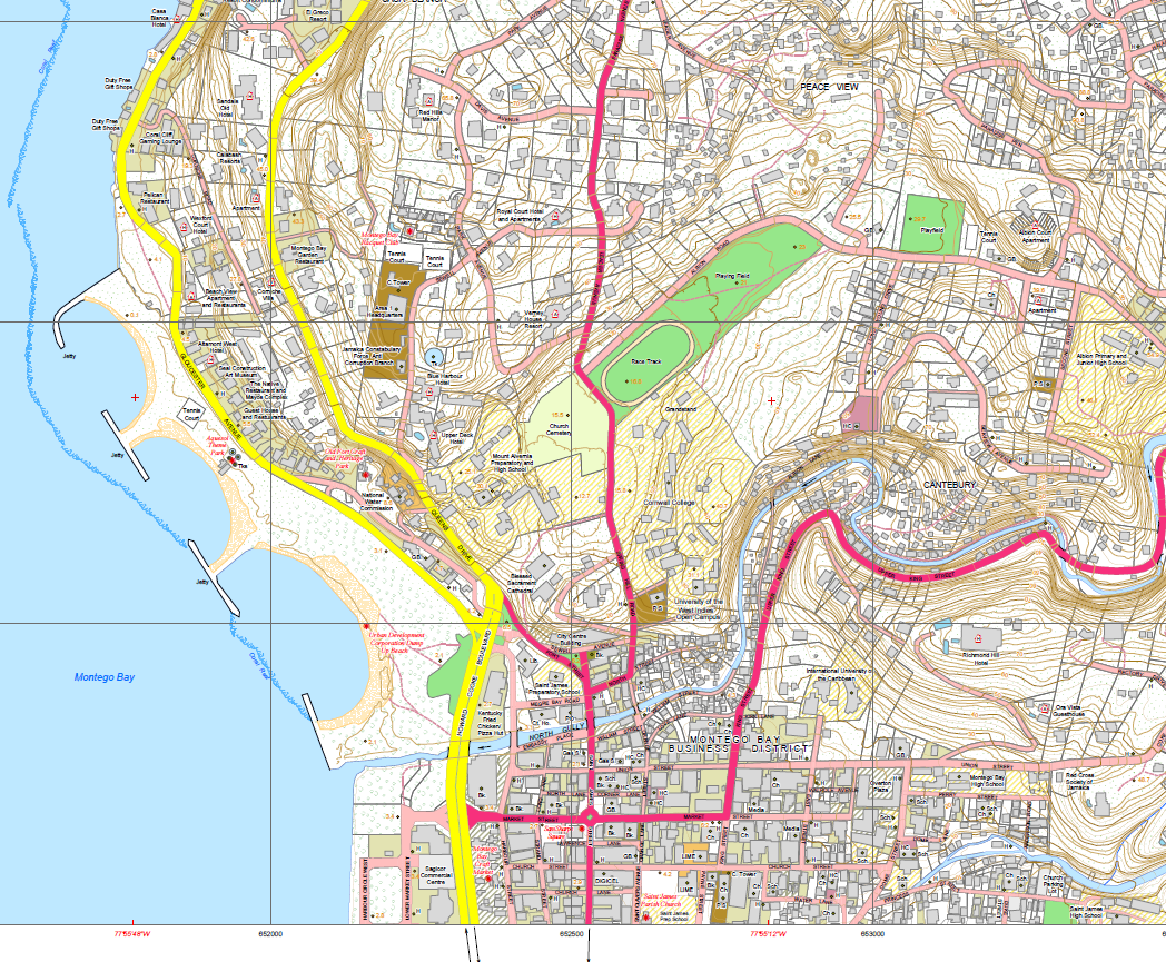
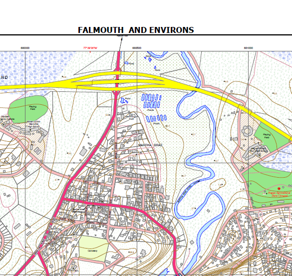
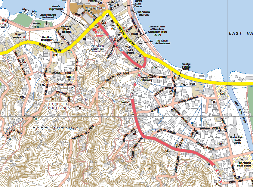
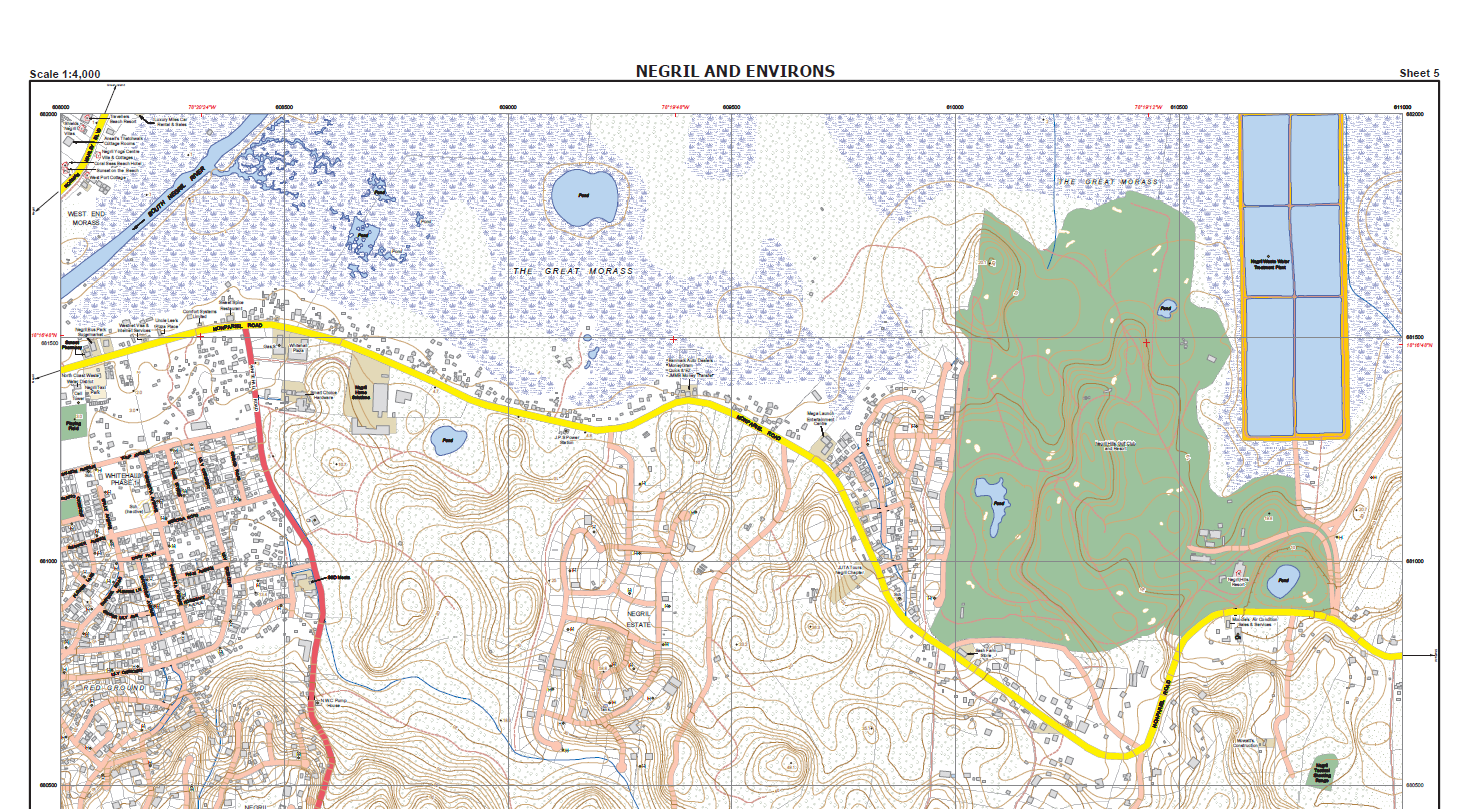
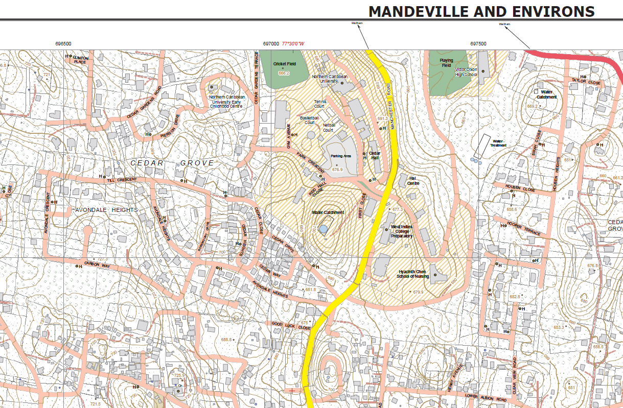
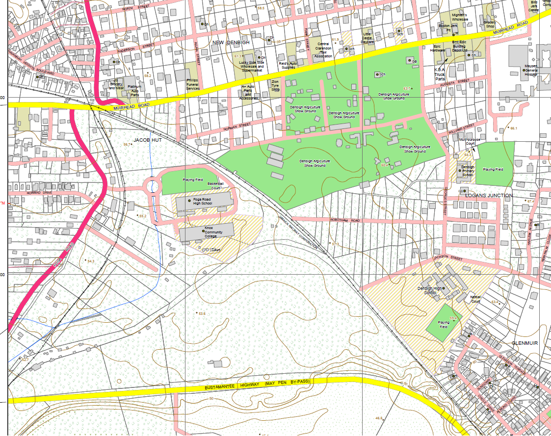
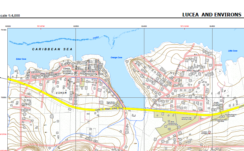
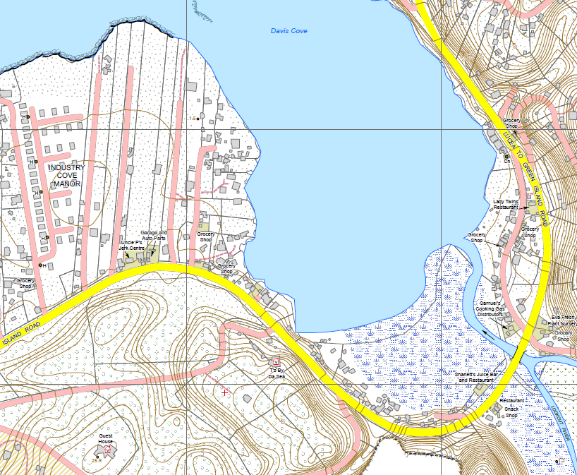
The Master Maps have been created with a significant level of detail and include the following features:
- Extensive coverage of parcel boundaries.
- Detailed road network showing major and minor roads.
- Contours and Spot Heights showing the elevation of the land.
- Building footprints of featured properties, indicating the shape of the structure within the parcel boundary.
- Points of interest and place names including hospitals, schools, churches, police and fire stations.
- Map Index which shows the relationship between each map sheet.
Benefits
- Customizable and available in digitial and paper based form.
- Contain both topographic and planimetric features.
- Highly accutate as details benefit from on ground verification before entry.
- Provide detailed coverage of all features within the major towns.
- Can be used across multiple sectors (education, surveying, construction, development, recreational purposes such as hiking etc.)
- Can be provided in Geo PDF which allows for its use as a navigation aid.
- Updated routinely to ensure that the information remains current.
The NLA, through the Surveys and Mapping Division, continues its work to modernize Jamaica’s national cadastre. The Agency is committed to national growth, through the development of a modern Multipurpose Land Information System, the foundation of which is grounded in maps such as our Master Map Series.
If you are interested in purchasing a Master Map Series or require further information please contact:
Business Services Division
23 ½ Charles Street, Kingston
Telephone: 876-750-5263 or 876-946-5263
WhatsApp: 876-418-5089
Email: asknla@nla.gov.jm
Workshops
Land Registration and Conveyancing Workshop starts May 13, 2025
Social Links
Live Chat Count Down
Contacts
For general information about our services, please contact us at:
- asknla@nla.gov.jm
- +876.750.5263
- +876.946.5263
- +876.418.5089
- 8 Ardenne Road Kingston 10